Kirjojen hintavertailu – 12 859 819 kirjaa ja 27 kauppaa

Kirjailija

David Brawn

Kirjat ja teokset yhdessä paikassa: 26 kirjaa, julkaisuja vuosilta 2006–2022, suosituimpiin kuuluu Rutland Water Challenge Map and Guide. Vertaile teosten hintoja ja tarkista saatavuus suomalaisista kirjakaupoista.

26 kirjaa

Kirjojen julkaisuvuodet: 2006–2022.

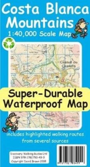
Costa Blanca Mountains Tour and Trail Map

Costa Blanca Mountains Tour and Trail Map

David Brawn

Discovery Walking Guides Ltd
2018
kartta

Halvin toimitettuna 20,90 €

For better adventures, use the best map. Costa Blanca Mountains Tour & Trail Super-Durable Map 2nd edition is the essential map for everyone looking to explore the exciting mountainous hinterland of the Costa Blanca. Whether you are exploring on foot, bike or horse this is your first choice map. Scale 1:40,000 2.5cms = 1km. Double-sided 780mm by 600mm folded to 21cm by 12cm. For the 2nd edition we have carried out a thorough makeover while also adding a large number of walking tracks and trails. Walk! the Costa Blanca Mountains' 37 walking routes are highlighted in red, Official PR/GR walking routes are highlighted in green. For the 2nd edition we have added 72 walking routes from the Costa Blanca Mountain Walkers website maintained by Bob and Jean Hall, these are highlighted in blue. Our red/green/blue highlighting makes it easy to identify your walking routes on the new map. We have also checked that Costa Blanca by Landscapes 13 walking routes are correctly shown, along with 27 walking routes from Costa Blanca by Rother. All the usual details of Tour & Trail Maps are included: Roads; Motorway, major roads, secondary roads, minor roads & tarmacked lanes including latest road numbering system. Tracks & Trails; Unsurfaced (dirt) roads and walking trails. Heights; 100 & 20 metre contours, height & trig points in metres, height background colours in 200 metre colour bands. UTM 1km Grid with WGS84 Datum. The map region is divided into North and South sheets with a generous overlap, and configured so that for the continuation North-South, or South-North, you simply turn the map sheet towards, or away, from you. Super-Durable means we print this map on a special material, using special inks combined with a unique curing to give a map that is as `tough as old boots' and which will take you through the toughest adventures and still fold up like new. DWG back Super-Durable Maps with a 2 Year Adventurous Use guarantee, see our website for details. A special map concertina map fold means your map unfolds easily and more importantly folds back easily to pocket sized folded format. Tour & Trail Super-Durable Maps are fully recyclable. Digital editions of our Costa Blanca Mountains Tour & Trail Map for phone app and Garmin users are available on our Discovery Walking Guides website.
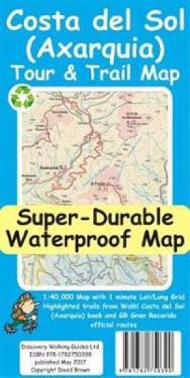
Costa del Sol (Axarquia) Tour and Trail Map

Costa del Sol (Axarquia) Tour and Trail Map

David Brawn

Discovery Walking Guides Ltd
2017
kartta
For better adventures, use the best map. Costa del Sol (Axarquia) Tour & Trail Super-Durable Map comes with a 2 year adventurous use wear and tear guarantee against splitting or falling apart, see Discovery Walking Guides website for details. Custom Map digital editions for gps phone apps and Garmin users are available from the Discovery Walking Guides website. Our large 1:40,000 scale, combined with splitting the region into West and East sections with a generous overlap, produces double sided map whose total size is 840mm by 700mm that folds to a pocketable 240mm by 120mm. Costa del Sol (Axarquia) covers the region from Ventas de Zafarraya in the North-West to Almunecar in the South-East; approx 3 42'W to 4 08'W and 36 43'N to 36 58'N. You get the most detailed map of the region that is produced including our 'Tour & Trail' level of detail ranging from major roads to secondary roads to minor roads to streets and narrow rural country roads, plus dirt roads and walking trails. Altitude background colouring is designed to clearly show the altitude range when travelling across the region by car or on foot. 100 metre and 50 metre contours are clearly shown on the map along with a large number of individual height points. Tour & Trail attention to detail is legendary as is our useful symbol range including miradors, picnic areas, petrol stations, bar/restaurants and parking areas where you can pull off the road safely. You will easily identify springs, caves, quarrys, sports grounds, cemeterys, churchs, chapels, lighthouses, towers and forts, camping areas, wind turbines, hotels and golf courses. For adventurers on foot Tour & Trail Maps are researched and designed by hikers for use by hikers. Our comprehensive gps ground surveys produce the best road mapping available but the value of this on the ground research becomes even more important when you leave the tarmac. All of our DWG walking routes are accurately gps surveyed giving you confidence in the accuracy of our Tour & Trail Maps. Costa del Sol (Axarquia) Tour & Trail Super-Durable Map includes all the walking routes from Walk! the Costa del Sol (Axarquia) which are specially highlighted (red outline) while the official GR (Gran Recorido) long distance trails are also specially highlighted (green outline) along with other local hiking routes. It all adds up to the most detailed, most durable, most useful map of the Costa del Sol (Axarquia) that you can buy anywhere. Super-Durable Maps are printed with 100% oxygenation inks on Polyart by the UK's leading map printer, which produces a map that feels like silk but will stand up to the roughest treatment of outdoor adventuring and yet fold up like new at the end of your adventure. 'Special Concertina Map Fold' makes Tour & Trail Maps easy to use, and more importantly easy to fold back to their handy pocket size. Polyart is made of high-density polyethylene (HDPE) and is therefore 100% recyclable in category 2 HDPE. For more information see the Polyart website.
Sierra de Aracena Tour & Trail Map

Sierra de Aracena Tour & Trail Map

David Brawn

Discovery Walking Guides Ltd
2016
kartta, viikattu

Halvin toimitettuna 9,90 €

1:40,000 scale topographical map covering the Sierra de Aracena region in northern Huelva/Andalucia. All walking routes from Sierra de Aracena - a Walk! Guidebook; are clearly highlighted. Discover the hidden Spain of western Andalucia which is a delight for leisure walkers who appreciate the natural world and 1st class culinary delights; the Jabugo pata negra ham and local setas make for a unique dining experience. 2nd edition includes 1 minute Lat/Long grid, road and development updates and specially highlighted walking trails. Produced to Tour & Trail standards resulting in a map of outstanding accuracy and clarity. Whether you are driving, walking, hiking, horse riding or mountain biking this is the map to carry with you. Digital editions of Tour & Trail Maps for phone apps and Garmin users are available on the dwgwalking website.
Ibiza Tour and Trail Map

Ibiza Tour and Trail Map

David Brawn

Discovery Walking Guides Ltd
2016
kartta, viikattu
For better adventures, use the best map. Water-proof, split-proof, tear-proof, adventure-proof. Ibiza Tour & Trail Super-Durable Map is simply the toughest, most accurate, easy to read, easy to use map of the island you can buy at any price. David & Ros Brawn have partnered with Walking World to include the highlighted routes for 39 detailed walking routes on the island, plus the 20 Official mountain bike cycling routes are also highlighted on their detailed routes. Large, 40k scale, easy to read map sheets include a wealth of useful details. 20 metre and 100 metre contours combined with altitude shading bring these impressive Ibiza landscapes to life. All of the legendary Tour & Trail attention to detail is included so that you will find those petrol stations, mirador viewpoints with parking, refreshment stops with parking and accurate road numbering that are so essential when adventuring by hire car. 'Off-Tarmac' Ibiza Tour & Trail Map is in a league of its own thanks to all those Walking World hiking trails (39) and the official mountain biking routes (20). Being such a large 40k scale map means that Ibiza covers both sides of the 840mm by 600mm super-durable map sheet with a generous 5.6 kilometre common overlap between the East and West map sheets, while still folding back to a pocketable 235mm by 120mm when folded. 'Super-Durable' means a waterproof, tear-proof, map that can take the roughest treatment and still folds up like new after your adventures. Printed on Polyart using specialist 100% oxygenation inks produces a lightweight map that feels like silk but is a tough as old boots as it shrugs off water, resists tearing and damage better than any other map. 'Super-Durable' combined with our special concertina map fold means this 'near indestructible' Tour & Trail Map unfolds easily for use, and more importantly folds back up easily to its compact pocket size even after the toughest use. Digital editions are available from Discovery Walking Guides website.
GPS the Easy Way

GPS the Easy Way

David Brawn

Discovery Walking Guides Ltd
2006
pokkari
The exercises using OS mapping and BNG co-ordinates deals with the GPS navigation for walkers. Exercises are replicated in the user's own region of UK. This is the 2nd edition of UK's best selling GPS manual.