Kirjojen hintavertailu – 12 903 735 kirjaa ja 27 kauppaa

Kirjailija

Fernando Almeida

Kirjat ja teokset yhdessä paikassa: 10 kirjaa, julkaisuja vuosilta 2012–2024, suosituimpiin kuuluu Investigación geofísica integrada de alta resolución de un monasterio. Vertaile teosten hintoja ja tarkista saatavuus suomalaisista kirjakaupoista.

10 kirjaa

Kirjojen julkaisuvuodet: 2012–2024.

The Business Plan Reference Manual for IT Businesses

The Business Plan Reference Manual for IT Businesses

Fernando Almeida; José Santos

River Publishers
2024
nidottu
There is a great worldwide desire to launch new technology-based business. In this sense, and increasingly, entrepreneurship courses have arisen in several universities and many of the courses in the management, administration and engineering areas already offer entrepreneurship curricular units. Throughout those programs, the teams develop key integrated competencies in innovation, entrepreneurship and technology that will ultimately enable the students to create and develop new technology-based businesses. The Business Plan Reference Manual for IT Businesses provides a reference manual for undergraduate and graduate students that intend to launch their start-up business in the IT field. It helps them to create and model the business plan of their business. Therefore, this manual is mainly aimed at instructors who want to offer a practical view of the process of modeling, designing and developing an IT start-up. Additionally, it can be individually used by entrepreneurs who wish to launch their start-up businesses in IT field. The structure of the book was defined taking into account different approaches to the construction of the business plan, which basically consider a disaggregation of some of these chapters in others smaller (e.g., marketing plan into products/services and market, financial plan into investment plan and economic-financial projections). We chose to aggregate these dimensions into a single chapter, which in our view facilitates the process of analyzing a business plan. It is also relevant to mention the inclusion of “Chapter V – Prototype description” which is innovative and intends to take into account the application of this business plan template to the information technology sector.
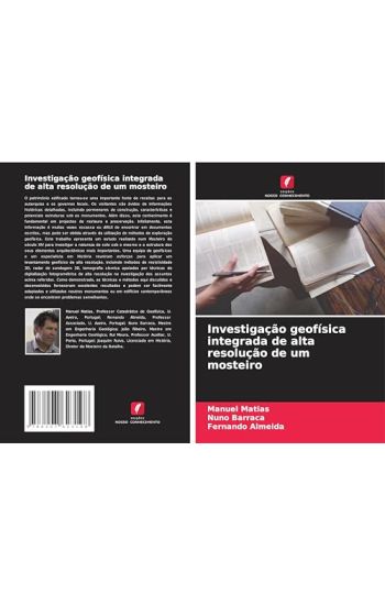
Investigação geofísica integrada de alta resolução de um mosteiro

Investigação geofísica integrada de alta resolução de um mosteiro

Manuel Matias; Nuno Barraca; Fernando Almeida

Edicoes Nosso Conhecimento
2024
pokkari
O patrim nio edificado tornou-se uma importante fonte de receitas para as autarquias e os governos locais. Os visitantes s o vidos de informa es hist ricas detalhadas, incluindo pormenores de constru o, caracter sticas e potenciais estruturas sob os monumentos. Al m disso, este conhecimento fundamental em projectos de restauro e preserva o. Infelizmente, esta informa o muitas vezes escassa ou dif cil de encontrar em documentos escritos, mas pode ser obtida atrav s da utiliza o de m todos de explora o geof sica. Este trabalho apresenta um estudo realizado num Mosteiro do s culo XIV para investigar a natureza do solo sob o mesmo e a estrutura dos seus elementos arquitect nicos mais importantes. Uma equipa de geof sicos e um especialista em Hist ria reuniram esfor os para aplicar um levantamento geof sico de alta resolu o, incluindo m todos de resistividade 3D, radar de sondagem 3D, tomografia s smica apoiados por t cnicas de digitaliza o fotogram trica de alta resolu o na investiga o dos assuntos acima referidos. Como demonstrado, as t cnicas e m todos aqui discutidos e desenvolvidos forneceram excelentes resultados e podem ser facilmente adaptados e utilizados noutros monumentos ou em edif cios contempor neos onde se encontrem problemas semelhantes.
Indagine geofisica integrata ad alta risoluzione di un monastero

Indagine geofisica integrata ad alta risoluzione di un monastero

Manuel Matias; Nuno Barraca; Fernando Almeida

Edizioni Sapienza
2024
pokkari
Il patrimonio edilizio diventato un'importante fonte di reddito per le amministrazioni e i governi locali. I visitatori sono avidi di informazioni storiche dettagliate, compresi i dettagli costruttivi, le caratteristiche e le potenziali strutture presenti sotto i monumenti. Inoltre, questa conoscenza fondamentale nei progetti di restauro e conservazione. Purtroppo, tali informazioni sono spesso scarse o difficili da reperire in documenti scritti, ma possono essere ottenute con l'uso di metodi di esplorazione geofisica. Questo lavoro presenta uno studio condotto in un monastero del XIV secolo per indagare la natura del terreno sottostante e la struttura dei suoi elementi architettonici pi importanti. Un' quipe di geofisici e uno specialista in Storia hanno raccolto gli sforzi per applicare un'indagine geofisica ad alta risoluzione, comprendente metodi di resistivit 3D, radar di sondaggio del terreno 3D e tomografia sismica, supportati da tecniche di scansione fotogrammetrica ad alta risoluzione, per indagare su questi aspetti. Come dimostrato, le tecniche e i metodi qui discussi e sviluppati hanno fornito risultati eccellenti e possono essere facilmente adattati e utilizzati in altri monumenti o in edifici contemporanei dove si possono riscontrare problemi simili.
Etude géophysique intégrée à haute résolution d'un monastère

Etude géophysique intégrée à haute résolution d'un monastère

Manuel Matias; Nuno Barraca; Fernando Almeida

Editions Notre Savoir
2024
pokkari
Le patrimoine b ti est devenu une importante source de revenus pour les conseils locaux et les gouvernements. Les visiteurs sont avides d'informations historiques d taill es, y compris les d tails de construction, les caract ristiques et les structures potentielles sous les monuments. De plus, cette connaissance est primordiale dans les projets de restauration et de pr servation. Malheureusement, ces informations sont souvent rares ou difficiles trouver dans les documents crits, mais elles peuvent tre obtenues gr ce aux m thodes d'exploration g ophysique. Cet ouvrage pr sente une tude men e dans un monast re du XIVe si cle afin d' tudier la nature du sol qui le recouvre et la structure de ses l ments architecturaux les plus importants. Une quipe de g ophysiciens et un sp cialiste de l'histoire ont rassembl leurs efforts pour appliquer une tude g ophysique haute r solution, y compris la r sistivit 3D, le radar de sondage du sol 3D, les m thodes de tomographie sismique soutenues par des techniques de balayage photogramm trique haute r solution dans l' tude des questions susmentionn es. Comme cela a t d montr , les techniques et les m thodes discut es et d velopp es ici ont fourni d'excellents r sultats et peuvent tre facilement adapt es et utilis es dans d'autres monuments ou dans des b timents contemporains o des probl mes similaires peuvent tre trouv s.
Integrierte hochauflösende geophysikalische Untersuchung eines Klosters

Integrierte hochauflösende geophysikalische Untersuchung eines Klosters

Manuel Matias; Nuno Barraca; Fernando Almeida

Verlag Unser Wissen
2024
pokkari
Das bauliche Erbe ist zu einer wichtigen Einnahmequelle f r Kommunen und Regierungen geworden. Besucher sind an detaillierten historischen Informationen interessiert, einschlie lich Konstruktionsdetails, Merkmale und m gliche Strukturen unter den Denkm lern. Au erdem ist dieses Wissen bei Restaurierungs- und Erhaltungsprojekten von gr ter Bedeutung. Leider sind solche Informationen in schriftlichen Dokumenten oft nur sp rlich oder schwer zu finden, aber sie k nnen durch den Einsatz von geophysikalischen Erkundungsmethoden gewonnen werden. In dieser Arbeit wird eine Studie vorgestellt, die in einem Kloster aus dem 14. Jahrhundert durchgef hrt wurde, um die Beschaffenheit des Untergrunds und die Struktur der wichtigsten architektonischen Elemente zu untersuchen. Jahrhundert durchgef hrt wurde, um die Beschaffenheit des Bodens und die Struktur der wichtigsten architektonischen Elemente des Klosters zu untersuchen. Ein Team aus Geophysikern und einem Spezialisten f r Geschichte hat sich bem ht, eine hochaufl sende geophysikalische Untersuchung durchzuf hren, einschlie lich 3D-Resistivit t, 3D-Bodensondierungsradar und seismische Tomographie, unterst tzt durch hochaufl sende Photogrammetrie-Scannertechniken, um die oben genannten Fragen zu untersuchen.
The Business Plan Reference Manual for IT Businesses

The Business Plan Reference Manual for IT Businesses

Fernando Almeida; José Santos

River Publishers
2018
sidottu
There is a great worldwide desire to launch new technology-based business. In this sense, and increasingly, entrepreneurship courses have arisen in several universities and many of the courses in the management, administration and engineering areas already offer entrepreneurship curricular units. Throughout those programs, the teams develop key integrated competencies in innovation, entrepreneurship and technology that will ultimately enable the students to create and develop new technology-based businesses. The Business Plan Reference Manual for IT Businesses provides a reference manual for undergraduate and graduate students that intend to launch their start-up business in the IT field. It helps them to create and model the business plan of their business. Therefore, this manual is mainly aimed at instructors who want to offer a practical view of the process of modeling, designing and developing an IT start-up. Additionally, it can be individually used by entrepreneurs who wish to launch their start-up businesses in IT field. The structure of the book was defined taking into account different approaches to the construction of the business plan, which basically consider a disaggregation of some of these chapters in others smaller (e.g., marketing plan into products/services and market, financial plan into investment plan and economic-financial projections). We chose to aggregate these dimensions into a single chapter, which in our view facilitates the process of analyzing a business plan. It is also relevant to mention the inclusion of “Chapter V – Prototype description” which is innovative and intends to take into account the application of this business plan template to the information technology sector.