Kirjojen hintavertailu – 12 859 827 kirjaa ja 27 kauppaa

Kirjailija

James G. Bockheim

Kirjat ja teokset yhdessä paikassa: 14 kirjaa, julkaisuja vuosilta 2014–2025, suosituimpiin kuuluu Soils of the Laurentian Great Lakes, USA and Canada. Vertaile teosten hintoja ja tarkista saatavuus suomalaisista kirjakaupoista.

14 kirjaa

Kirjojen julkaisuvuodet: 2014–2025.

Soils of the Laurentian Great Lakes, USA and Canada

Soils of the Laurentian Great Lakes, USA and Canada

James G. Bockheim

Springer Nature Switzerland AG
2021
nidottu
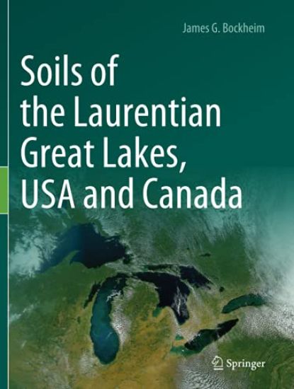
This book introduces the reader to the Great Lakes and considers their soil-forming factors and processes, taxonomic structure of the soils, soil geography and pedodiversity, while also addressing the importance and protection of soils in the Great Lakes Coastal Zone. The Great Lakes are an important part of the USA and Canada. Home to 33 million people, including 90% of all Canadians, the Great Lakes account for 20% of the world’s surface freshwater and 90% of the USA’s freshwater. Key industries include shipping, steel and automobile production, energy generation, fishing, pulp and papermaking, agriculture, and recreation. To date, there has been no comprehensive inventory of the region’s soils, which are now subject to dramatic climate change and environmental degradation. This book was prepared using the US Department of Agriculture, Natural Resources Conservation Service databases, including the Web Soil Survey, Soil Series Extent Explorer, soil classification and characterization databases, and county soil surveys, supplemented by shoreline viewer software, the author’s independent research, consultation with colleagues, and survey trips around the Great Lakes.
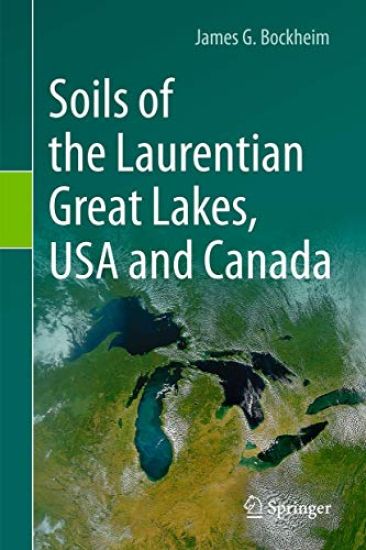
Soils of the Laurentian Great Lakes, USA and Canada

Soils of the Laurentian Great Lakes, USA and Canada

James G. Bockheim

Springer Nature Switzerland AG
2020
sidottu
This book introduces the reader to the Great Lakes and considers their soil-forming factors and processes, taxonomic structure of the soils, soil geography and pedodiversity, while also addressing the importance and protection of soils in the Great Lakes Coastal Zone. The Great Lakes are an important part of the USA and Canada. Home to 33 million people, including 90% of all Canadians, the Great Lakes account for 20% of the world’s surface freshwater and 90% of the USA’s freshwater. Key industries include shipping, steel and automobile production, energy generation, fishing, pulp and papermaking, agriculture, and recreation. To date, there has been no comprehensive inventory of the region’s soils, which are now subject to dramatic climate change and environmental degradation. This book was prepared using the US Department of Agriculture, Natural Resources Conservation Service databases, including the Web Soil Survey, Soil Series Extent Explorer, soil classification and characterization databases, and county soil surveys, supplemented by shoreline viewer software, the author’s independent research, consultation with colleagues, and survey trips around the Great Lakes.
The Soils of Mississippi

The Soils of Mississippi

Delaney Johnson; Mike Lilly; Birl Lowery; James G. Bockheim

Springer International Publishing AG
2025
nidottu
This book capitalizes on data collected by the Natural Resources Conservation Service & other organizations over the past 100+ years & offers the first comprehensive treatment of Mississippi soils. Main topics include the history of soil studies; soil-forming factors; general soil regions; taxonomic soil regions; soil-forming processes; benchmark, endemic, rare, & endangered soils; land use; key environmental issues; & yield potential of Mississippi soils. The book contains over 100 photographs of soils, vegetation, & land use & should be of interest to planners & students interested in soil science & allied disciplines.
The Soils of Mississippi

The Soils of Mississippi

Delaney Johnson; Mike Lilly; Birl Lowery; James G. Bockheim

Springer International Publishing AG
2024
sidottu
This book capitalizes on data collected by the Natural Resources Conservation Service & other organizations over the past 100+ years & offers the first comprehensive treatment of Mississippi soils. Main topics include the history of soil studies; soil-forming factors; general soil regions; taxonomic soil regions; soil-forming processes; benchmark, endemic, rare, & endangered soils; land use; key environmental issues; & yield potential of Mississippi soils. The book contains over 100 photographs of soils, vegetation, & land use & should be of interest to planners & students interested in soil science & allied disciplines.
The Soils of Oregon

The Soils of Oregon

Thor Thorson; Chad McGrath; Dean Moberg; Matthew Fillmore; Steven Campbell; Duane Lammers; James G. Bockheim

Springer Nature Switzerland AG
2023
nidottu
This book is the only comprehensive summary of natural resources of Oregon and adds to World Soil Book Series state-level collection. Due to broad latitudinal and elevation differences, Oregon has an exceptionally diverse climate, which exerts a major influence on soil formation. The mean annual temperature in Oregon ranges from 0°C in the Wallowa and Blue Mountains of northeastern Oregon to 13 °C in south-central Oregon. The mean annual precipitation ranges from 175 mm in southeastern Oregon to over 5,000 mm at higher elevations in the Coast Range. The dominant vegetation type in Oregon is temperate shrublands, followed by forests dominated by lodgepole pine, Douglas-fir, and mixed conifers, grasslands, subalpine forests, maritime Sitka spruce-western hemlock forests, and ponderosa pine-dominated forests. Oregon is divided into 17 Major Land Resource Areas, the largest of which include the Malheur High Plateau, the Cascade Mountains, the Blue Mountain Foothills, and Blue Mountains. The single most important geologic event in Oregon was the deposition of Mazama ash 7,700 years by the explosion of Mt. Mazama. Oregon has soil series representative of 10 orders, 40 suborders, 114 great groups, 389 subgroups, over 1,000 families, and over 1,700 soil series. Mollisols are the dominant order in Oregon, followed by Aridisols, Inceptisols, Andisols, Ultisols, and Alfisols. Soils in Oregon are used primarily for forest products, livestock grazing, agricultural crops, and wildlife management. Key land use issues in Oregon are climate change; wetland loss; flooding; landslides; volcanoes, earthquakes, and tsunamis; coastal erosion; and wildfires.
The Soils of Oregon

The Soils of Oregon

Thor Thorson; Chad McGrath; Dean Moberg; Matthew Fillmore; Steven Campbell; Duane Lammers; James G. Bockheim

Springer Nature Switzerland AG
2022
sidottu
This book is the only comprehensive summary of natural resources of Oregon and adds to World Soil Book Series state-level collection. Due to broad latitudinal and elevation differences, Oregon has an exceptionally diverse climate, which exerts a major influence on soil formation. The mean annual temperature in Oregon ranges from 0°C in the Wallowa and Blue Mountains of northeastern Oregon to 13 °C in south-central Oregon. The mean annual precipitation ranges from 175 mm in southeastern Oregon to over 5,000 mm at higher elevations in the Coast Range. The dominant vegetation type in Oregon is temperate shrublands, followed by forests dominated by lodgepole pine, Douglas-fir, and mixed conifers, grasslands, subalpine forests, maritime Sitka spruce-western hemlock forests, and ponderosa pine-dominated forests. Oregon is divided into 17 Major Land Resource Areas, the largest of which include the Malheur High Plateau, the Cascade Mountains, the Blue Mountain Foothills, and Blue Mountains. The single most important geologic event in Oregon was the deposition of Mazama ash 7,700 years by the explosion of Mt. Mazama. Oregon has soil series representative of 10 orders, 40 suborders, 114 great groups, 389 subgroups, over 1,000 families, and over 1,700 soil series. Mollisols are the dominant order in Oregon, followed by Aridisols, Inceptisols, Andisols, Ultisols, and Alfisols. Soils in Oregon are used primarily for forest products, livestock grazing, agricultural crops, and wildlife management. Key land use issues in Oregon are climate change; wetland loss; flooding; landslides; volcanoes, earthquakes, and tsunamis; coastal erosion; and wildfires.
The Soils of Nevada

The Soils of Nevada

Paul W. Blackburn; John B. Fisher; William E. Dollarhide; Douglas J. Merkler; Joseph V. Chiaretti; James G. Bockheim

Springer Nature Switzerland AG
2021
nidottu
This book discusses Nevada in the context of the history of soil investigations; soil-forming factors; general soil regions; soil geomorphology; taxonomic structure of the soils; taxonomic soil regions; soil-forming processes; benchmark, endemic, rare, and endangered soils; and use of soils. With an average mean annual precipitation of 175 mm (7 in), Nevada is the driest state in the USA. More than three-quarters (89%) of the state has been mapped and the first soil survey was completed in 1909. Nevada is divided into 10 major land-resource areas and features two large deserts (the Great Basin Desert and the Mojave Desert), and over 100 north–south trending enclosed basins separated by mountain ranges (Basin and Range Province), several of which have peaks exceeding 3,400 m. Further, the soils of Nevada represent seven of the 12 globally recognized orders, 29 suborders, 69 great groups, and over 1,800 soil series, and some of the classic research on the origin of duripans andpetrocalcic horizons was conducted in the state. This book presents the first report on the soils of Nevada and provides the first soil map of Nevada utilizing soil.
The Soils of Nevada

The Soils of Nevada

Paul W. Blackburn; John B. Fisher; William E. Dollarhide; Douglas J. Merkler; Joseph V. Chiaretti; James G. Bockheim

Springer Nature Switzerland AG
2020
sidottu
This book discusses Nevada in the context of the history of soil investigations; soil-forming factors; general soil regions; soil geomorphology; taxonomic structure of the soils; taxonomic soil regions; soil-forming processes; benchmark, endemic, rare, and endangered soils; and use of soils. With an average mean annual precipitation of 175 mm (7 in), Nevada is the driest state in the USA. More than three-quarters (89%) of the state has been mapped and the first soil survey was completed in 1909. Nevada is divided into 10 major land-resource areas and features two large deserts (the Great Basin Desert and the Mojave Desert), and over 100 north–south trending enclosed basins separated by mountain ranges (Basin and Range Province), several of which have peaks exceeding 3,400 m. Further, the soils of Nevada represent seven of the 12 globally recognized orders, 29 suborders, 69 great groups, and over 1,800 soil series, and some of the classic research on the origin of duripans andpetrocalcic horizons was conducted in the state. This book presents the first report on the soils of Nevada and provides the first soil map of Nevada utilizing soil.
The Soils of Wisconsin

The Soils of Wisconsin

James G. Bockheim; Alfred E. Hartemink

Springer International Publishing AG
2018
nidottu
This book provides an up-to-date and comprehensive report on the soils of Wisconsin, a state that offers a rich tapestry of soils. It discusses the relevant soil forming factors and soil processes in detail and subsequently reviews the main soil regions and dominant soil orders, including paleosols and endemic and endangered soils. The last chapters address soils in a changing climate and provide an evaluation of their monetary value and crop yield potential. Richly illustrated, the book offers both a valuable teaching resource and essential guide for policymakers, land users, and all those interested in the soils of Wisconsin.
The Soils of Wisconsin

The Soils of Wisconsin

James G. Bockheim; Alfred E. Hartemink

Springer International Publishing AG
2017
sidottu
This book provides an up-to-date and comprehensive report on the soils of Wisconsin, a state that offers a rich tapestry of soils. It discusses the relevant soil forming factors and soil processes in detail and subsequently reviews the main soil regions and dominant soil orders, including paleosols and endemic and endangered soils. The last chapters address soils in a changing climate and provide an evaluation of their monetary value and crop yield potential. Richly illustrated, the book offers both a valuable teaching resource and essential guide for policymakers, land users, and all those interested in the soils of Wisconsin.
Soil Geography of the USA

Soil Geography of the USA

James G. Bockheim

Springer International Publishing AG
2016
nidottu
Since 1980, our understanding of the factors and processes governing the distribution of soils on the Earth’s surface has increased dramatically, as have the techniques for studying soil patterns. The approach used in this book relies on the National Resources Conservation Service databases to delineate the distribution of each of the eight diagnostic epipedons and 19 subsurface horizons, to identify the taxonomic level at which each of these horizons is used, to develop an understanding of the role of the factors and processes in their formation and to summarize our latest understanding of their genesis. A chapter is devoted to each diagnostic horizon (or combined horizons). This book is intended to serve as a textbook in soil geography, a reference book for geographers, ecologists and geologists and a tool for soil instructors, landlookers, mappers, classifiers and information technologists.
Cryopedology

Cryopedology

James G. Bockheim

Springer International Publishing AG
2016
nidottu
This is the first book solely devoted to Cryopedology, the study of soils of cold regions. The analysis treats Cryosols as a three-part system (active layer, transition layer, permafrost). The book considers soil-forming factors, cryogenic processes, and classification and distribution of Cryosols. Cryosols of the Arctic, Antarctica, and the high mountains are considered in detail. The chapters address cryosols and earth-system science, cryosols in a changing climate, cryosols databases and their use, and management of cryosols. The book is rich in color photographs and highlights the author’s 43 field trips to Antarctica, the Arctic, and alpine areas.
Cryopedology

Cryopedology

James G. Bockheim

Springer International Publishing AG
2014
sidottu
This is the first book solely devoted to Cryopedology, the study of soils of cold regions. The analysis treats Cryosols as a three-part system (active layer, transition layer, permafrost). The book considers soil-forming factors, cryogenic processes, and classification and distribution of Cryosols. Cryosols of the Arctic, Antarctica, and the high mountains are considered in detail. The chapters address cryosols and earth-system science, cryosols in a changing climate, cryosols databases and their use, and management of cryosols. The book is rich in color photographs and highlights the author’s 43 field trips to Antarctica, the Arctic, and alpine areas.
Soil Geography of the USA

Soil Geography of the USA

James G. Bockheim

Springer International Publishing AG
2014
sidottu
Since 1980, our understanding of the factors and processes governing the distribution of soils on the Earth’s surface has increased dramatically, as have the techniques for studying soil patterns. The approach used in this book relies on the National Resources Conservation Service databases to delineate the distribution of each of the eight diagnostic epipedons and 19 subsurface horizons, to identify the taxonomic level at which each of these horizons is used, to develop an understanding of the role of the factors and processes in their formation and to summarize our latest understanding of their genesis. A chapter is devoted to each diagnostic horizon (or combined horizons). This book is intended to serve as a textbook in soil geography, a reference book for geographers, ecologists and geologists and a tool for soil instructors, landlookers, mappers, classifiers and information technologists.