Kirjojen hintavertailu – 12 903 725 kirjaa ja 27 kauppaa

Kirjailija

James Rennell

Kirjat ja teokset yhdessä paikassa: 32 kirjaa, julkaisuja vuosilta 2008–2026, suosituimpiin kuuluu The Journal of Frederick Horneman's Travels, From Cairo to Mourzouk, the Capital of the Kingdom of Fezzan, in Africa, in the Years 1797-8 (Cram Edition). Vertaile teosten hintoja ja tarkista saatavuus suomalaisista kirjakaupoista.

32 kirjaa

Kirjojen julkaisuvuodet: 2008–2026.

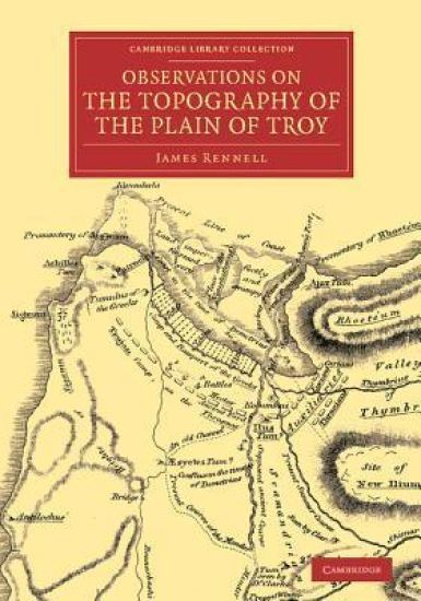
Observations on the Topography of the Plain of Troy

Observations on the Topography of the Plain of Troy

James Rennell

Cambridge University Press
2014
pokkari
James Rennell (1742–1830) could be claimed as the father of historical geography. After a long career at sea and in India, during which he had learned surveying and cartography, he returned to England and entered the circle of Sir Joseph Banks, who encouraged him to widen his interests to include the geography of the ancient world. In this work, published in 1814, Rennell compares the actual topography of the area in which Troy was believed to be located with the accounts of ancient commentators on Homer, with the Homeric accounts themselves, and finally with the work of ancient geographers. Without offering his own solution to the problem, he demolishes with zest the then current theory that Troy was located at the village of Bournabashi - a conclusion with which Heinrich Schliemann later agreed. Rennell's posthumously published work on the topography of Western Asia is also reissued in this series.
Observations on the Topography of the Plain of Troy, and on the Principal Objects Within and Around It Described or Alluded to in the Iliad. Shewing That the System of M. de Chevalier [Le Chevalier] Is Founded on a Most Erroneous Topography.
Title: Observations on the topography of the Plain of Troy, and on the principal objects within and around it described or alluded to in the Iliad. Shewing that the system of M. de Chevalier Le Chevalier] ... is founded on a most erroneous topography, etc. Publisher: British Library, Historical Print EditionsThe British Library is the national library of the United Kingdom. It is one of the world's largest research libraries holding over 150 million items in all known languages and formats: books, journals, newspapers, sound recordings, patents, maps, stamps, prints and much more. Its collections include around 14 million books, along with substantial additional collections of manuscripts and historical items dating back as far as 300 BC. The GEOGRAPHY & TOPOGRAPHY collection includes books from the British Library digitised by Microsoft. Offering some insights into the study and mapping of the natural world, this collection includes texts on Babylon, the geographies of China, and the medieval Islamic world. Also included are regional geographies and volumes on environmental determinism, topographical analyses of England, China, ancient Jerusalem, and significant tracts of North America. ++++The below data was compiled from various identification fields in the bibliographic record of this title. This data is provided as an additional tool in helping to insure edition identification: ++++ British Library Rennell, James; Lechevalier, Jean Baptiste.; 1814. xxii. 156 p.; 4 . G.7822.(1.)
A description of the roads in Bengal and Bahar. Containing I. The direct roads from Calcutta to all the cities, ... II. III. IV. The direct roads from the three other principal cities, ... V. The cross roads ... with an index.
The 18th century was a wealth of knowledge, exploration and rapidly growing technology and expanding record-keeping made possible by advances in the printing press. In its determination to preserve the century of revolution, Gale initiated a revolution of its own: digitization of epic proportions to preserve these invaluable works in the largest archive of its kind. Now for the first time these high-quality digital copies of original 18th century manuscripts are available in print, making them highly accessible to libraries, undergraduate students, and independent scholars. Rich in titles on English life and social history, this collection spans the world as it was known to eighteenth-century historians and explorers. Titles include a wealth of travel accounts and diaries, histories of nations from throughout the world, and maps and charts of a world that was still being discovered. Students of the War of American Independence will find fascinating accounts from the British side of conflict. ++++The below data was compiled from various identification fields in the bibliographic record of this title. This data is provided as an additional tool in helping to insure edition identification: ++++British LibraryN028529Anonymous. By James Rennell. London]: Printed by order of the Honourable the Court of Directors of the East India Company, 1779. 4],337, 3]p., plate: map; 4
An Account of the Ganges and Burrampooter Rivers.... Read at the Royal Society, January 25, 1780.
The 18th century was a wealth of knowledge, exploration and rapidly growing technology and expanding record-keeping made possible by advances in the printing press. In its determination to preserve the century of revolution, Gale initiated a revolution of its own: digitization of epic proportions to preserve these invaluable works in the largest archive of its kind. Now for the first time these high-quality digital copies of original 18th century manuscripts are available in print, making them highly accessible to libraries, undergraduate students, and independent scholars. Rich in titles on English life and social history, this collection spans the world as it was known to eighteenth-century historians and explorers. Titles include a wealth of travel accounts and diaries, histories of nations from throughout the world, and maps and charts of a world that was still being discovered. Students of the War of American Independence will find fascinating accounts from the British side of conflict. ++++The below data was compiled from various identification fields in the bibliographic record of this title. This data is provided as an additional tool in helping to insure edition identification: ++++British LibraryT113764London: printed by J. Nichols (successor to Mr. Bowyer), 1781. 30p., plate: map; 4