Kirjojen hintavertailu – 12 859 829 kirjaa ja 27 kauppaa

Kirjailija

John Zant

Kirjat ja teokset yhdessä paikassa: 5 kirjaa, julkaisuja vuosilta 2009–2024, suosituimpiin kuuluu St Michael's Church, Workington. Vertaile teosten hintoja ja tarkista saatavuus suomalaisista kirjakaupoista.

5 kirjaa

Kirjojen julkaisuvuodet: 2009–2024.

St Michael's Church, Workington

St Michael's Church, Workington

John Zant; Adam Parsons

Oxford Archaeology North
2019
nidottu
In September 1994, the parish church of St Michael, Workington, was badly damaged by fire, reducing the interior to a shell. The church’s history extends back to at least the twelfth century, and an existing collection of eighth- to eleventh-century sculpture hinted at more ancient origins. Therefore, before reconstruction began, a programme of archaeological works was undertaken, yielding further, highly significant, evidence for an early medieval Christian presence on the site, including fragments of sculpture and a large number of burials, as well as information on the later medieval and post-medieval churches, and their associated cemetery. The project has provided a rare opportunity to study the origins of one of the earliest, and long-lived, early medieval Christian cemeteries in North-west England. The work focused upon the evidence for pre-Norman ecclesiastical activity and the earliest phases of the medieval parish church, together with the skeletal remains, and artefacts. It also provided an opportunity to conduct a series of scientific investigations on the material, since bone rarely survives in Cumbria, This included radiocarbon dating, isotope analysis, and osteological analysis, providing the earliest radiocarbon dates from such a cemetery in Cumbria, indeed in the North, and two clear phases of burial, the second, closely dated to the eleventh century, containing evidence of a particularly gruesome end for one of the interred. The large collection of mid-tenth- to early eleventh-century sculpture, decorated with Scandinavian-derived motifs and interlace, and items of personal dress and jewellery, indicated the evolving tastes of the patrons. This has allowed a better understanding of the lives of this community, and their changing burial traditions. Perhaps most importantly, the site provided an opportunity to marry the patchy historical framework of the region with archaeological evidence, providing information for how people responded to the changing tastes, politics, and events within the landscape of the North West in the early medieval period.
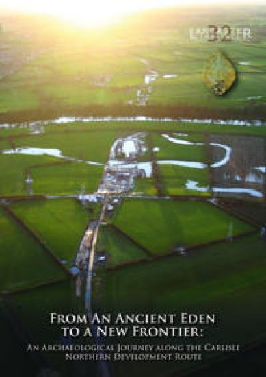
From an Ancient Eden to a New Frontier

From an Ancient Eden to a New Frontier

Fraser Brown; Paul Clark; Anthony Dickson; Richard Gregory; John Zant

Oxford Archaeology North
2024
nidottu
The Carlisle Northern Development Route (CNDR) is a major road around the western side of Carlisle. Prior to its construction, there was an extensive programme of archaeological excavation, carried out along its route by Oxford Archaeology, between May 2008 and April 2011. The excavations recorded archaeological and palaeoenvironmental remains at several sites (termed ‘parcels’) along this route, including highly significant remains dating to the Mesolithic and Neolithic periods at Stainton West (Parcel 27 North), a site situated on the floodplain north of the River Eden. These related to a Mesolithic seasonal, aggregation encampment, dating between c. 6000 cal BC and c. 4300 cal BC. This was on an island between two palaeochannels and was associated with domestic features and an in-situ flaked-lithic assemblage of over 300,000 pieces, dominated by a narrow-blade lithic technology. Waterlogged deposits of organic sediment and the remains of a beaver lodge and dam in the main palaeochannel defining the western edge of the island, also contained a wealth of palaeoenvironmental evidence relevant to the earlier part of the period in which the encampment was occupied. Neolithic activity began in c. 3800-3700 cal BC comprising the construction of a wooden platform in the main palaeochannel, which was associated with the intentional deposition of tree-felling debris, coarse-stone tools, flaked lithics, pottery, and wooden artefacts, including a paddle and two ‘tridents’. Palaeoenvironmental remains relating to this activity were also recovered, providing evidence for an elm decline, and herding and small-scale arable farming. Later Neolithic activity was also evident in the form of two burnt mounds, established during the first half of the third millennium cal BC. The investigations also revealed evidence for Chalcolithic and Bronze Age activity, which included a sequence of burnt mounds at Stainton West, used until approximately 1600 cal BC. Several other sites along the scheme provided evidence for settlement and agriculture, dating between the twenty-third and the ninth centuries cal BC, which included structures, roundhouses, boundary ditches, ceramics, and plant remains. During the construction works, a transect across the Hadrian’s Wall Roman frontier was also examined at Knockupworth. This identified the initial, Hadrianic, phase of Turf Wall, the subsequent slighting of both this and the Vallum earthworks to the south, and the Stone Wall constructed, around AD 158-60, when the Hadrianic frontier was reoccupied following abandonment of the Antonine Wall. Important evidence for early medieval activity was also revealed. Five apparently near-contemporary rectangular posthole buildings dated to the early eighth to mid-tenth centuries AD, and probably formed a small agricultural settlement. Other remains along the route related to the agricultural landscape that existed in the later medieval and post-medieval periods.
Roman and Medieval Carlisle

Roman and Medieval Carlisle

John Zant; Christine Howard-Davis

Oxford Archaeology North
2022
nidottu
Carlisle City Council redeveloped the Lanes from the mid-1970s, a densely built-up area in the north-east corner of the city’s historic core, crossed by 19 narrow ‘vennels’. These, together with most of the adjacent buildings, were swept away by the construction of the Lanes shopping centre. Previous archaeological work had confirmed complex Roman and medieval deposits on the site, most of which would be destroyed by the development, and many of the buildings were of historical and architectural interest. A programme of archaeological and historical investigation, including building recording, was therefore undertaken, principally funded by Carlisle City Council, the Department of the Environment (now Historic England), and the Manpower Services Commission, completed between 1978 and 1982. Historic England also funded the post-excavation analysis and this publication. The Lanes remains one of the largest and most significant archaeological projects ever undertaken in northern England. The project was split into the northern and southern Lanes, the results of the latter being published in 2000, though it only included a summary of the standing-building survey. This volume, the companion to the 2019 publication of the Roman remains at the northern site, presents the evidence for post-Roman activity. The site appears to have been abandoned by the fifth century, layers of ‘dark earth’ accumulating over the latest Roman levels. Several decades after Carlisle was re-established by William II, narrow burgage plots were created, extending from Scotch Street to the recently constructed city wall. These were intensively occupied from then on and yielded a wealth of evidence for the everyday lives of the inhabitants. Around the mid-thirteenth century, the lanes themselves were created between these plots, probably to improve access, and this distinctive pattern of land-use persisted until the modern redevelopment.
The Maryport Roman Settlement Project

The Maryport Roman Settlement Project

John Zant

Oxford Archaeology North
2019
Nidottu
In August and September 2013, and again in April and May 2014, Oxford Archaeology, on behalf of the former Hadrian's Wall Trust (HWT), undertook a research and community-training excavation within the extramural settlement associated with the Roman fort at Maryport, Cumbria. The project sought to engage, and train, a wide cross-section of the community in a broad range of fieldwork and post-excavation techniques, and to address a series of academic research questions pertaining to the Maryport site, and to Roman extramural settlements in general. Based on the evidence of an extensive programme of geophysical survey undertaken on the site in 2000-4, a block of four putative Roman building plots was selected for investigation, north-west of the main axial road leading north-east from the fort (which appears to have formed the principal focus of settlement on this side of the fort). Following an initial phase of prospection at the beginning of the 2013 season, which included a ground-penetrating radar (GPR) survey and the excavation of four test-pits, what was thought to be a single building plot was selected for more detailed investigation. Open-area excavation within this putative plot quickly established that in fact it comprised a complete building plot, considerably narrower than was suggested by the geophysical survey data, and substantive parts of two others, to the north-east and south-west, with a probable external area, including what may have been a minor road, between the central and south-western plots. The primary aim of the project was to enhance understanding of this part of the settlement through the excavation of as much as possible of a single building plot (including the 'backplot' area to the rear of the street frontage); consequently, the fully exposed central plot was chosen for more extensive excavation. The south-western and north-eastern plots were not excavated, other than to establish the presence of stone/stone-footed buildings within them. The 2014 season was focused almost exclusively on the central plot, with the area investigated within the backplot being substantially enlarged. However, a small area immediately to the south was also excavated, to investigate stratigraphic links between the structures in the central plot and what appeared to be an external area adjacent to them. The earliest evidence for a human presence at the site comprised a few prehistoric stone artefacts, intensive occupation clearly beginning in the Roman period. The main road leading north-east from the fort was identified, with the three building plots extending westwards from it. Following its initial construction, the road was resurfaced only once, in the third century AD. The stratigraphically earliest feature recorded was a small, north-east/south-west-aligned ditch, approximately 10 m north-west of, and aligned broadly parallel to, the road, possibly part of a field system of late pre-Roman or (perhaps more likely) early Roman date. The ceramic evidence from the site provides a strong indication that the investigated area as a whole saw little activity before the late Hadrianic period (c AD 130+), when a rectilinear timber building, probably a strip building, was constructed on the frontage of the targeted building plot. Since this structure clearly referenced the position and alignment of the axial road, this proves that this road was in existence by the late Hadrianic period and was not, like the Military Way associated with Hadrian's Wall, a later feature. The limited dating evidence associated with the building suggests that it may have remained in use to around the middle of the second century, probably sometime within the period 140-60, but it appears to have been immediately replaced with another, very similar, timber structure. This indicates that no break in occupation occurred at the time Hadrian's Wall was abandoned in favour of the Antonine Wall across the Forth-Clyde isthmus.