
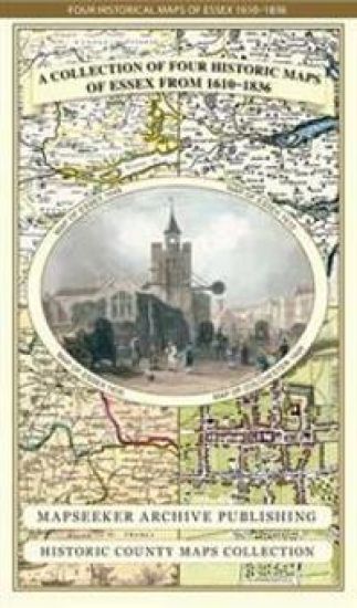
Essex 1610 – 1836 – Fold Up Map that features a collection of Four Historic Maps, John Speed’s County Map 1610, Johan Blaeu’s County Map of 1648, Thomas Moules County Map of 1836 and a Plan of Colchester 1805 by Cole and Roper. – hinnat ja saatavuus
Kirjafiili on kirjojen hintavertailu. Löydä halvin hinta 27 kirjakaupasta. Hintavertailu koskee ISBN-tunnusta 9781844918300 (kartta, viikattu).
Kirjan kuvaus
This folded map (890mm x 1000mm when unfolded) is an ideal souvenir for tourists to Essex and also a valuable reference resource for local and family history research. It includes 4 Historic maps of Essex, John Speed's County Map of… Näytä koko kuvaus Piilota kuvaus
This folded map (890mm x 1000mm when unfolded) is an ideal souvenir for tourists to Essex and also a valuable reference resource for local and family history research. It includes 4 Historic maps of Essex, John Speed's County Map of Essex1611, Johan Blaeu's County Map of Devon 1648,Thomas Moule's County Map of Essex 1836 and the detailed Plan of Colchester 1805 by Cole and Roper. All the maps have been meticulously re-produced from antique originals and printed on 90 gsm "Progeo" paper which was specially developed as a map paper. It has high opacity to help reduce show through and a cross grain giving it greater durability to as the map is being folded.
Kirjan tiedot
Vertaa kirjan ”Essex 1610 – 1836 – Fold Up Map that features a collection of Four Historic Maps, John Speed’s County Map 1610, Johan Blaeu’s County Map of 1648, Thomas Moules County Map of 1836 and a Plan of Colchester 1805 by Cole and Roper.” hintoja
Vertaa tuotteen hintaa ja arvioitua kokonaishintaa toimitettuna. Kaikki hinnat koskevat ISBN-tunnusta 9781844918300.
Hintoja ei päivitetty automaattisesti. Voit hakea ajantasaiset hinnat painamalla Hae hinnat.

Booky

Suomalainen

Kansallinen Kirjakauppa

Prisma

Finlandia Kirja

Fantasiapelit

Vinhan kirjakauppa

CDON

Kustantamo S&S

Kennys.ie

Kristillinenkirjakauppa.fi

Sacrum

Adlibris

BookOutlet.fi

Kirja.fi

Rosebud
Tälle kirjalle ei ole tällä hetkellä vahvistettua hintaa. Tarkista tilanne myöhemmin uudelleen.
Hintoja ei ole vielä päivitetty.
Hälytys tallennettu!
Ilmoitamme, kun hinta laskee.
Saat sähköpostin, kun hinta laskee asettamaasi rajaan tai sen alle.
Essex 1610 – 1836 – Fold Up Map that features a collection of Four Historic Maps, John Speed’s County Map 1610, Johan Blaeu’s County Map of 1648, Thomas Moules County Map of 1836 and a Plan of Colchester 1805 by Cole and Roper. – hintahistoria
Seuraamme kirjan Essex 1610 – 1836 – Fold Up Map that features a collection of Four Historic Maps, John Speed’s County Map 1610, Johan Blaeu’s County Map of 1648, Thomas Moules County Map of 1836 and a Plan of Colchester 1805 by Cole and Roper. hintakehitystä kirjakaupoissa. Taulukosta näet viime kuukausien alimmat hinnat.
Alin hinta kauppoittain
Kunkin kaupan alin hinta viimeisten 90 päivän aikana.
Hintahistoriaa ei ole vielä kerätty tälle kirjalle.
Hinnat ilman toimituskuluja.