
Rhodes Tour and Trail Map – hinnat ja saatavuus
Kirjafiili on kirjojen hintavertailu. Löydä halvin hinta 27 kirjakaupasta. Hintavertailu koskee ISBN-tunnusta 9781782750796 (kartta, viikattu).
Kirjan kuvaus
For your best adventures, use the best map. Water-proof, split-proof, tear-proof. Rhodes Tour & Trail Super-Durable Map is simply the toughest, most accurate, easy to read, easy to use map that you can buy at any price. A large 960mm by… Näytä koko kuvaus Piilota kuvaus
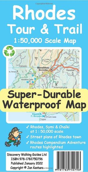
For your best adventures, use the best map. Water-proof, split-proof, tear-proof. Rhodes Tour & Trail Super-Durable Map is simply the toughest, most accurate, easy to read, easy to use map that you can buy at any price. A large 960mm by 700mm double sided map sheet covers Rhodes at 1:50,000 scale and includes Chalki and Symi islets. On the cover side is Rhodes South with Chalki and Symi, with Rhodes North and street plans of Rhodes Town on the reverse. We have two street plans of the capital town. Rhodes Town greater area is at 12k scale, including Acropolis in the west and spanning beyond Rodini park in the south. The other street plan shows the fortified Old Town in great detail at 5k scale. DWG's special concertina map fold makes our map easy to open and easy to refold to its 233mm by 120mm pocket size. Our legendary 'Tour & Trail' level of detail ranges from major roads to secondary roads to minor roads to streets and narrow country roads, plus dirt roads, tracks and walking trails. Place names are in English and Greek to aid your navigation. Altitude shading is designed to clearly show the altitude range when travelling across the island by car or on foot. 20 metre and 100 metre contours combined with altitude shading bring this beautiful landscape to life. There are plenty of individual height points and all of the official 'Trig' points are on the map. Tour & Trail attention to detail includes our useful symbol range including viewpoints, picnic areas, petrol stations, bar/restaurants and parking areas where you can pull off the road safely. You will easily identify springs, caves, sports grounds, cemeteries, monasteries, churches, chapels, lighthouses, castles, camping areas, wind turbines, windmills, hotels etc. Rhodes Compendium of Walking Adventures walking routes (all 98 walking routes) are specially highlighted on the map. It all adds up to the most detailed, most durable map of Rhodes, Chalki and Symi that you can buy anywhere. 'Super-Durable' means a waterproof, tear-proof, map that can take the roughest treatment and still folds up like new after your adventures. Super-Durable Maps come with a 2 year adventurous use 'Wear and Tear' guarantee. Digital editions of our Rhodes Tour & Trail Map are available as in-app purchases for Outdooractive and Locus Map apps. Discovery Walking Guides offer digital editions of Rhodes Tour & Trail Map in kmz (Garmin), sqlite.db for apps, and Oziexplorer formats, see website dwgwalking.co.uk for details.
Kirjan tiedot
Vertaa kirjan ”Rhodes Tour and Trail Map” hintoja
Vertaa tuotteen hintaa ja arvioitua kokonaishintaa toimitettuna. Kaikki hinnat koskevat ISBN-tunnusta 9781782750796.
Hintoja ei päivitetty automaattisesti. Voit hakea ajantasaiset hinnat painamalla Hae hinnat.

Booky

Suomalainen

Kansallinen Kirjakauppa

Prisma

Finlandia Kirja

Fantasiapelit

Vinhan kirjakauppa

CDON

Kustantamo S&S

Kennys.ie

Kristillinenkirjakauppa.fi

Sacrum

Adlibris

BookOutlet.fi

Kirja.fi

Rosebud
Tälle kirjalle ei ole tällä hetkellä vahvistettua hintaa. Tarkista tilanne myöhemmin uudelleen.
Hintoja ei ole vielä päivitetty.
Hälytys tallennettu!
Ilmoitamme, kun hinta laskee.
Saat sähköpostin, kun hinta laskee asettamaasi rajaan tai sen alle.
Rhodes Tour and Trail Map – hintahistoria
Seuraamme kirjan Rhodes Tour and Trail Map hintakehitystä kirjakaupoissa. Taulukosta näet viime kuukausien alimmat hinnat.
Alin hinta kauppoittain
Kunkin kaupan alin hinta viimeisten 90 päivän aikana.
Hintahistoriaa ei ole vielä kerätty tälle kirjalle.
Hinnat ilman toimituskuluja.